Today, I learned that:
The custom of numbering the houses on a street, in order to facilitate visits, delivery of mail and parcels, etc., is said to have started in 1512, when there was built a new bridge in Paris, Pont Notre-Dame. On the bridge were built 68 equal houses and in order to distinguish one from another, they were given golden numbers on the outside, with odd numbers on one side and even numbers on the other side of the bridge. Initially, the purpose of this numbering was not so much to find the house for a visit, but sort of registration of property.
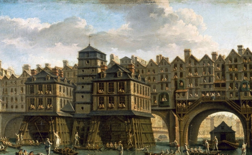
La Joute des mariniers entre le Pont-Notre-Dame et le Pont-au-Change, painted by Nicolas-Jean-Baptiste Raguenet in 1752.
Today, practically all towns and cities have a numbering system, although there are differences. The article in Wikipedia, referenced below, deals with the numbering in most parts of the world, so I will not repeat it, but recommend it if you are interested in knowing further details. Here, I will only give some bullet points and also complement that article with some interesting pieces of information.
The basic rule is that the numbering starts in some place with high importance to the city, e.g. City hall, Main cathedral, etc. So the point of the street that is closest to this reference point receives the lowest number and the numbering then increases when you move away from the reference point. It is also very common that one side of the street, normally the left side, receives odd numbers and the other (right) side gets even numbers, just like in Paris in 1512. However, there are exceptions, where the odd numbers are used on the right side and even numbers on the left side.
The distribution of the numbers can be either sequential or by distance. The traditional, sequential distribution, such as 1, 3, 5, 7, 9, 11, … only indicates the relative position of a certain building compared to the reference point and other buildings on the same side of the street, but does not necessarily include information about the distances involved. This type of distribution is prevalent in Europe and many of its former colonies.
However, a different number distribution is very common in USA and Canada. It is basically the same as for sequential distribution, but usually all numbers are not present. The increase in the number used on a building, when compared to its neighbour located closer to the reference point, signifies roughly the distance (in yards) between the two. This distribution system goes hand in hand with the distribution of houses in blocks, and where each new block starts with a multiple of 100. Of course this means that it is easier to know how big is the distance still to be covered to the desired building, merely subtracting one number from the other.
Yesterday, I wrote about São Paulo, and since Brazil is not covered in this Wikipedia article, let me complement it with some information also from Brazil. The predominant system here is similar to the one used in North America, except that the distance is measured in meters, since Brazil uses the SI system. However, there are some Brazilian cities that use the sequential distribution, e.g. Santos, which celebrates its birthday today, being founded on January 26, 1546. However, the 8-year younger city, São Paulo, uses the distribution by distance, where most of the streets rely on Praça da Sé, the city center, as the reference point. However, in the Southern Zone of São Paulo, that until 1935 was the autonomous city of Santo Amaro, the numbering starts at the Cathedral of Santo Amaro.
… That’s what I learned in school!
Refs.:
1: House numbering
+: What did you learn in school today ?